Near sunset across northern mainland Spain and the Balearic Islands.
The ultimate eclipse simulator
Ray-trace the 2026, 2027, and 2028 total solar eclipses against true 30-meter elevation profiles, contact timings, and satellite weather.
02:06
Three chances.
One clear view.
Spain is about to get a rare run of spectacular eclipses. Pick an event, then let the planner help you choose the ground beneath it.
A narrow, powerful path through Ceuta, Melilla and southern Andalusia.
A ring of fire near sunset across south-eastern Spain and the Balearics.
Not a guess.
A measurement.
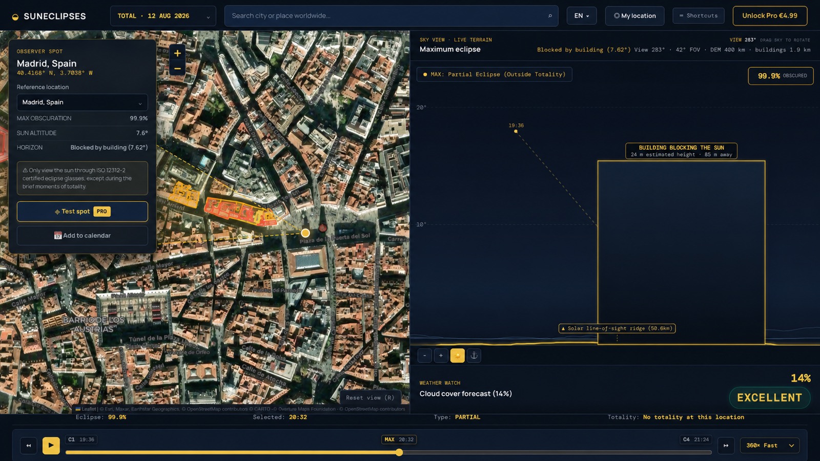
This is the real simulator — the same terrain ray-tracing, building horizon detection and live weather you'll use to pick your spot. Here it caught a 24m building blocking the sun from a Madrid rooftop.
Built for eclipse day,
not just eclipse maps.
Every tool you actually need between now and totality, in one calm interface.
Terrain + building ray-tracing
Curvature- and refraction-aware horizon checks against global 30m DEM terrain and nearby building obstructions.
Worldwide location search
Search any place on Earth, or drop a pin on the exact ridge, beach or rooftop you're considering.
Live weather forecast
Cloud cover and rain risk for your exact spot and eclipse date, pulled from live satellite forecasts.
Add to calendar
Export your contact times — C1 through C4 — straight to your calendar in your own local timezone.
12 languages
Fully translated for eclipse chasers across Europe, Japan and China.
Safety built in
Clear ISO 12312-2 certified eclipse glasses guidance so you're ready before totality.
Not just the path.
The place.
SunEclipses combines eclipse geometry, solar altitude, terrain-facing horizon profiles and practical weather context into one calm decision. Because two points inside the same path can feel worlds apart.
Coverage, duration and mountain horizon obstacle checks, made comparable.
See the western mountain ridge before the sun dips below it during sunset totality.
Test a second or third viewing location and compare their live weather forecasts before you commit.
Before you
commit to a spot.
How accurate is the terrain horizon?
We analyse global 30m-resolution DEM terrain across a 400km range centred on the solar azimuth, with Earth curvature and a standard atmospheric refraction coefficient applied. It's planning-grade, not a land survey — always verify marginal sightlines on site.
What if my spot turns out cloudy?
The planner shows a live weather forecast — cloud cover and rain risk for your exact coordinates — once your eclipse date is close enough to forecast, typically within about two weeks. Further out, weather simply isn't predictable yet, so check back closer to eclipse day before finalising your spot.
What do I get for free vs. with Pro?
Free lets you explore seven preset cities and the full methodology at no cost. Pro (€4.99, one-time, no subscription) unlocks dropping a pin anywhere on Earth, your GPS location, and worldwide place search.
Does this work outside Spain?
Yes — the terrain and solar geometry engine works anywhere on Earth. Spain is the focus for 2026–2028 because of the rare run of three eclipses, but you can test any coordinate worldwide.
The sky won't wait.
Make your plan.
Drop a pin anywhere on Earth, search any place worldwide, use your GPS location, and check live weather forecasts for eclipse day.